
Welcome
Mount Rainier Learning Module
By: Kim Carsell
Department of Geography
University of Colorado at Colorado Springs
Developed as part of the University of Colorado's GeographyWeb project,
a multi-campus effort to enhance geography education through the use of technology.
Project Directors: A. David Hill, University of Colorado at Boulder
and Eve Gruntfest, University of Colorado at Colorado Springs.
Course Introduction
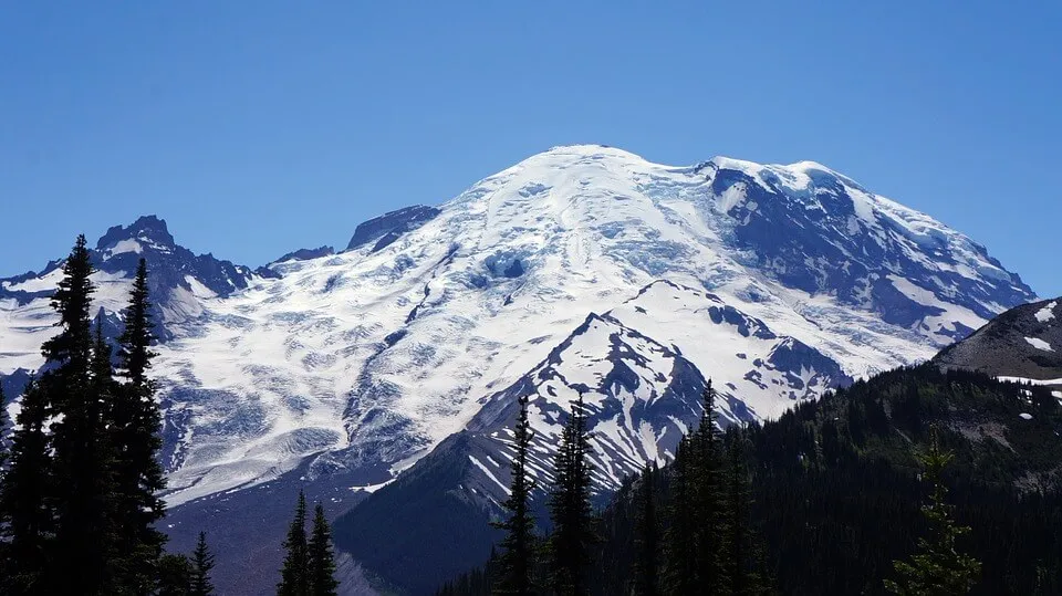
Are Volcanoes Really a Concern in the United States?
In 1997, popular movies have shown the catastrophic impact from fictional volcanic eruptions on American cities. Do you think this could really happen? Whether they realize it or not, millions of U.S. residents live in the shadow of active volcanoes. Through this module, you will learn about the hazards of one of the many volcanoes in the United States.
Learning Goals
As a result of this lesson, you will be able to answer the following questions:
- Why is Mount Rainier considered a dangerous volcano?
- What hazards does this volcano present - is an eruption all we should fear?
- Which specific areas are in danger?
- Which areas have been affected in the past?
- What can be done to reduce the hazards?
- How does Mount Rainier compare to other deadly volcanoes worldwide?
Getting Started & Learning From Experience Icon
Click on the Let's Get Started button and do the four lessons in order. The bottom of each page contains a link to the next page. You should explore each link in the lessons to gain a full understanding of the topic. The Learning from Experience icon provides real-life examples of volcanic phenomena. At the conclusion of each lesson, there are review questions for you to answer. For those who want to investigate this subject further, there is a list of World Wide Web sites for your enjoyment.
Outline of Pages
An outline of pages is also available if you need assistance navigating through the module.
Works Cited
This module is based on a variety of sources about Mount Rainier; a complete Works Cited list is provided.
U.S. Geological Survey's Cascades Volcano Observatory (CVO)
Unless otherwise stated, all the images and maps come from the U.S. Geological Survey's Cascades Volcano Observatory (CVO) and are used with permission.