
Lesson 1: Geographical Context
Cascade Range
Mount Rainier is one of about two dozen volcanoes of the Pacific Northwest known as the Cascade Range. This range of volcanoes extends 1,000 miles from northern California to southern British Columbia (USGS open file 94-585) and includes the recently erupted Mount St. Helens. The Cascade Range volcanoes, known as stratovolcanoes, have fewer but much more violent eruptions than shield volcanoes - such as those found in Hawaii.
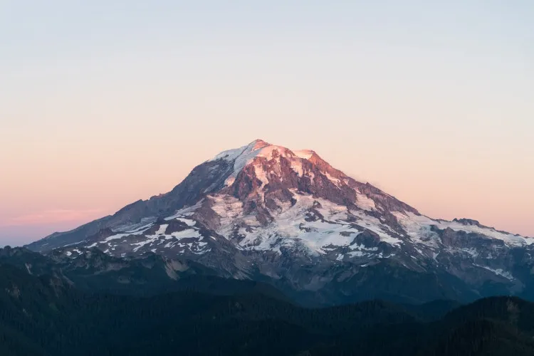
The highest volcano in the Cascade Range is Mount Rainier - rising to a height of 14,410 feet above sea level with a relief of almost 10,000 feet from valley floor to summit. It has more ice and snow than any of the other Cascade volcanoes in the form of 26 glaciers (Brantley 1994:19). Melt water from Rainier's glaciers feeds into five major rivers and their tributaries that lead into the Puget Sound and the Columbia River - both of which are major shipping areas. Also present on Mount Rainier's slopes are many ice caves or "steam caves." According to Harris and Kiver, Mount Rainier is one of the few volcanoes in the world to have extensive steam caves (134).
Mount Rainier National Park
Location
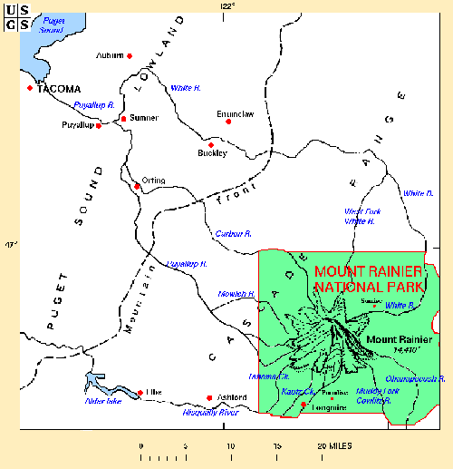
Mount Rainier is located 87 miles from Seattle, 65 miles from Tacoma, and towers over many closer towns. These include Ashford, Buckley, Eatonville, Elbe, Orting, Sumner, Puyallup, and more. This area, referred to as the Seattle-Tacoma metropolitan, is home to over 2.5 million people (U.S. Geodynamics Committee, 1994:1). Economically, this area is important to the Pacific Northwest, as it is one of the high-technology industry centers of the region and one of the major centers for manufacturing commercial airlines in the United States (U.S. Geodynamics Committee, 1994:1).
Welcome to Tourists
Mount Rainier National Park, established in 1899, surrounds the volcano and covers 378 square miles of wilderness (Harris and Kiver, 1985:131). According to park officials, over two million people visit this park every year to hike, climb, camp, and generally enjoy the beautiful forests, waterfalls, and wildlife found within its borders. The above map shows the national park boundaries.
Review Questions
Next:
Continue with Mount Rainier - Lesson 2